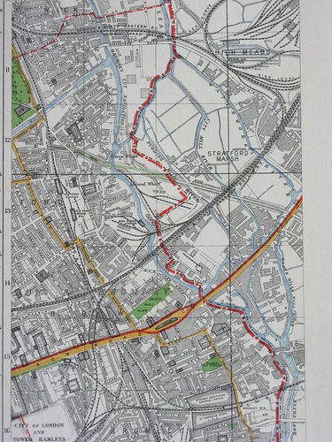
Hackney Wick - Bromley by Bow - Lea Valley, east London map, c1930, originally uploaded by mikeyashworth.
This c1930 map clearly shows the barrier that the River Lea (or Lee) had effectively created to the eastern expansion of London having been 'infilled' with industry that clung to the various waterways, canals and later rail connections. Running east - west you can see the main Bow Road and the bridges across the various river branches to Stratford. Above - the main line railway runs across, with the old North London Railway running north - south - this now forms part of the DLR at its southern end. This landscape has changed radically over the last few decades as the industry collapsed - and now much has been swept away as this forms the core of the new 2012 Olympic Park.